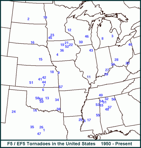
Below is a map showing the 58 “official” F5 or EF5 tornadoes since statistics began being kept by the Storm Prediction Center branch of the National Weather Service. You will notice tornadoes of this magnitude have struck in 19 different states. Some states, like Alabama and Oklahoma (with seven F5/EF5 strikes each – most of any state), have been hit several times. Somehow, right in the middle of this, Arkansas has yet to be struck by a highest end tornado. This post takes a look at the events that came closest to breaking the F5/EF5 barrier in Arkansas.
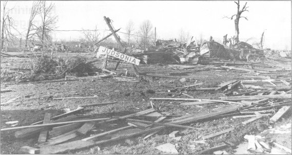
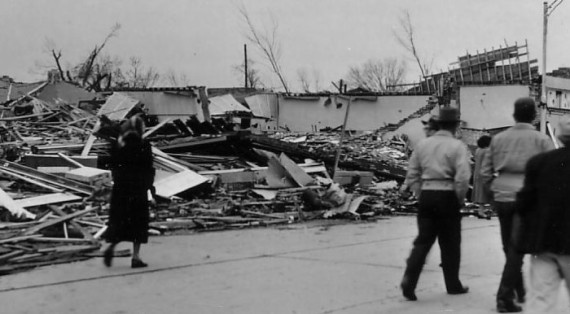
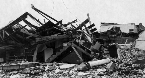
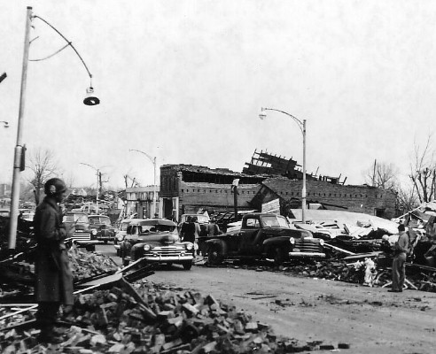
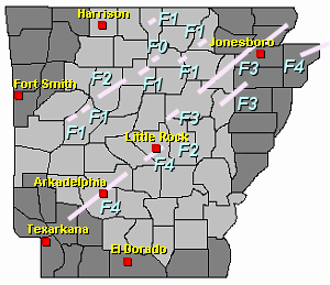
Since 1950, 28 tornadoes have been rated F4 or EF4 in Arkansas. On March 21-22, 1952 a major tornado outbreak resulted in 33 known tornadoes (there were certainly more, but tornadoes were not tracked as well then) resulting in 209 fatalities across five states. Arkansas was hit hardest with 112 fatalities. Five of these tornadoes were rated F4. The first F4 with a path of 13 miles struck in Howard County, particularly the small community of Dierks, resulting in seven fatalities. Just over two hours later the same supercell produced a massive tornado in White County, one mile wide at times, along it’s 14.6 mile path. The town of Judsonia was hit hardest, with 30 fatalities as the tornado tore through the business district. 385 homes were destroyed and 560 were damaged. Ten more were killed near Bald Knob, and ten others were killed in rural areas and near Russell.
Ten minutes later another F4 struck in Lonoke County near Wattensaw, killing two along a 7.6 mile path – some dispute remains over this tornado and it’s possible it’s path length. Another F4 struck in Woodruff county just 30 minutes later – all 29 deaths occurred in the town of Cotton Plant and the northwestern portion of the town was devastated. The town of Hilleman also was heavily damaged. Just 30 minutes later another F4 strength tornado – possibly the same one that struck Wattensaw – struck in Cross County, killing four in the community of Hickory Ridge. It is possible these were not two separate tornadoes, but one long-track tornado (with a path of roughly 65 miles) – but for now the record book indicates separate tornadoes. In all this outbreak produced 11 “violent” tornadoes (tornadoes of F4/F5 or EF4/EF5 strength) – the fourth most in a single outbreak since 1950 – surpassed only by the 1965 Palm Sunday Outbreak, the 1974 Super Outbreak and the 2011 Super Outbreak.
Other F4 rated tornadoes struck on December 19, 1957 (two fatalities), April 10, 1965 (a day before the Palm Sunday outbreak, a tornado in Faulkner County resulted in six fatalities, and two hundred injuries), April 3, 1968 and April 19, 1968.
On May 15, 1968 a significant tornado outbreak struck the Midwest and the South. 46 confirmed tornadoes (again, there were certainly more) resulted in 72 fatalities, including 45 in Arkansas. The first F4 struck in Independence County, killing seven and causing heavy damage in the town of Oil Trough. Just a few minutes later, another tornado touched down in Jackson County, starting a 21 mile path through Jackson, Craighead and Mississippi Counties, killing 35 people and injuring nearly 400. The university town (Arkansas State) of Jonesboro was hit particularly hard. Numerous fatalities occurred in automobiles, thrown and wrapped around trees. Other towns hit by this twister included Fairview, Nettleton and Manila. Two tornadoes on this same day in Iowa were both rated F5, though neither resulted in the sheer quantity of damage and loss of life as the Jonesboro F4 tornado.
A long-track F4 tornado sturck Woodruff, Jackson, Poinsett and Craighead Counties on May 26, 1973 resulting in three fatalities and 289 injuries – alarmingly close to the 1968 storm. This same day another F4, with a path of over 120 miles devastated Brent, Alabama. On March 28, 1975 another F4 in Bradley County killed seven and injured 51. On April 2, 1982 a long-track F4 tore through Sevier, Howard and Hempstead Counties, killing three and injuring 23 along it’s 54.8 mile path – this was part of a large outbreak resulting in 29 fatalities nationwide, with Oklahoma and Texas hit particularly hard. On Christmas Eve 1982, an even longer track tornado struck Sharp and Fulton Counties in Arkansas before crossing into Missouri, traveling 63 miles total but fortunately resulting in no fatalities. On March 15, 1984 a pair of F4 tornadoes struck – the first in Van Buren, Cleburne and Independence Counties, traveling 41 miles and killing two – the second in Jackson and Poinsett Counties, traveling 26 miles, and killing five. It would be over a decade before another F4 would strike, but on April 14, 1996, an F4 traveled 44 miles through Stone and Izard Counties killing seven and injuring 35.
A major tornado outbreak on March 1, 1997. 39 tornadoes struck Arkansas, Tennessee and Kentucky, with Arkansas hardest hit. Five tornadoes would be rated F4. The first killed six in Clark County, with the town of Arkadelphia hardest hit – 60 blocks were severely damaged and 400 homes, mobile homes or businesses were destroyed. A second F4 would strike Hot Spring County but some show this as the same tornado that struck Clark County. If combined, the path is 51 miles.
Almost simultaneously, two significant tornadoes touched down shortly after the Arkadelphia tornado. The first was an F3 that traveled for 68 miles, killing four and causing it’s worst damage in the town of Marmaduke. The second was an F4 that touched down in Saline County, traveled for 14 miles and killed ten. Some dispute again exists with the Saline County tornado. The official SPC database shows two separate tornadoes traveling through Saline and Pulaski counties, but others show them as one tornado with a combined path of 25 miles and a combined 15 fatalities. The Shannon Hills area southwest of Little Rock was devastated, and the second tornado (or latter parts of one tornado) caused significant damage to south and eastern suburbs of Little Rock. Both the Arkadelphia tornado and the Saline/Pulaski County tornado(tornadoes) were from the same supercell thunderstorm. Another F4 struck in Mississippi County but caused minimal damage.
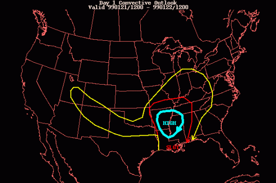
Mississippi County didn’t have to wait long for another F4 tornado – on April 16, 1998 an F4 struck killing two and injuring 12, this was part of a large outbreak that resulted in 16 fatalities nationally, and an F5 tornado in Tennessee. On January 21, 1999 a major tornado outbreak struck Louisiana, Arkansas, Mississippi and Tennessee – the largest ever recorded in the month of January – resulting in 127 tornadoes over three days and nine fatalities. Only one was rated F4, a tornado striking in Clay County, Arkansas which fortunately hit very little and caused no fatalities or injuries. Unfortunately an F3 hit the suburbs of Little Rock, killing three
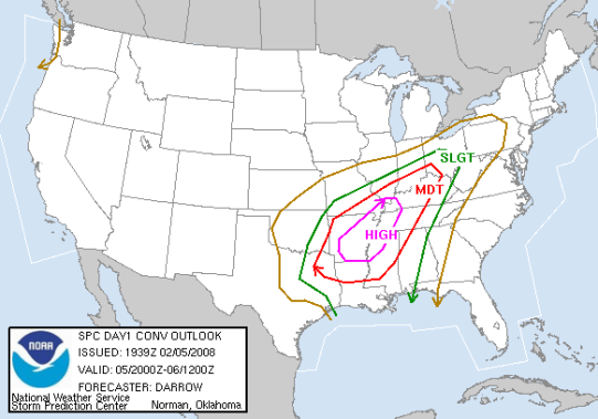
More than a decade would pass before Arkansas’ next F4. By February 5, 2008, the old Fujita Scale had been replaced by the Enhanced Fujita Scale. Another unusually early season outbreak was forecast for “Dixie Alley”, and Arkansas would not be left out. The Super Tuesday Outbreak (named so because 24 states were holding primary elections for the upcoming presidential election) would see 87 confirmed tornadoes result in 56 fatalities – the most in a tornadic event since 1985. While Tennessee suffered the most fatalities, the most spectacular tornado of the outbreak was one of it’s earliest which struck in Arkansas.
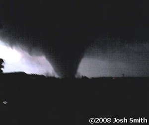
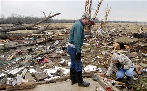
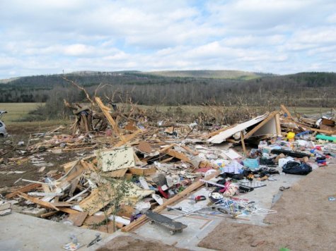
At 4:49pm a tornado touched down in Yell County and began what would be a 121.84 mile trip across Yell, Pope, Conway, Van Buren, Stone, Izard and Sharp Counties before dissipating. The tornado hit hardest in the communities of Atkins, Clinton and Mountain View, and resulted in 13 fatalities and 139 injuries. The 121 mile path is, by official records at least, the longest tornado path in Arkansas history (1950-present).
On May 24, 2011 – just two days after the historic Joplin EF5 tornado, another major tornado outbreak struck Oklahoma, carrying over into Arkansas in the evening hours. A tornado would strike the town of Denning in the dark, killing four and injuring 27 along a 45.7 mile path. Oklahoma would also record a pair of EF4 tornadoes this day, as well as an EF5.
Three years to the date of the largest tornado outbreak in recorded United States history, the SPC issued a high risk of severe weather squarely over Arkansas. While activity was less than expected, a powerful tornado struck the communities of Mayflower and Vilonia, which had been hit by an EF2 tornado three years earlier. It was part of a multi-day outbreak which resulted in 35 fatalities and 84 tornadoes.
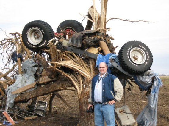
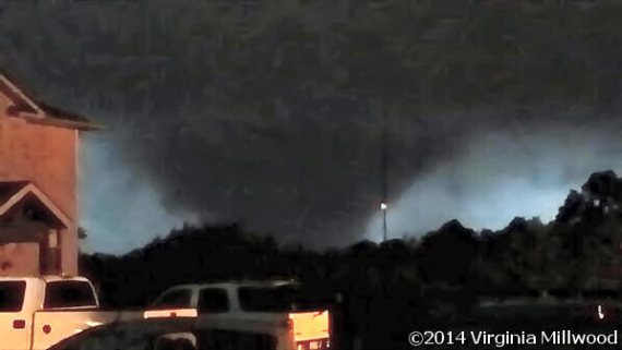
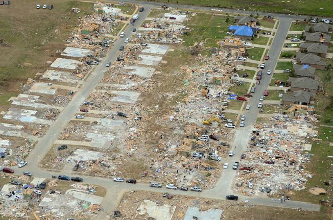
The tornado that would devastate Mayflower and Vilonia touched down at 7:06pm in western Pulaski County. After crossing over Lake Maumelle, the tornado crossed into Faulkner County and reduced two-story homes to piles of debris in Mayflower. Concrete road barriers were blown over, and as the tornado crossed Arkansas highway 365, cars and semi-trucks were thrown. After briefly weakening while crossing Lake Conway, the tornado re-intensified before plowing into Vilonia at 7:50pm. Homes were obliterated, swept from their foundations, and cars were thrown hundreds of yards. The tornado dissipated at 8:06 near the community of El Paso. The tornado was on the ground for an hour, traveled 41 miles and killed 16 people.
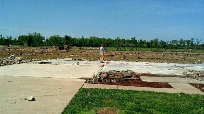
The EF4 rating for the Vilonia tornado received considerable criticism. The Little Rock office of the National Weather Service noted that if this tornado had occurred prior to the change in the EF scale in 2007, it likely would have been rated as an F5 due to numerous homes being swept clean from their foundations. However, it was revealed that almost every home in Vilonia lacked anchor bolts and were anchored with cut nails instead. The new scale accounts for homes that use cut nails instead of anchor bolts, which do not effectively provide resistance against violent tornadoes. The final decision on an EF4 rating was based on this as well. Despite this, further inspection from surveyors revealed that one home that was swept away along East Wicker Street was indeed properly bolted to its foundation. However, an inspection of the context surrounding the house revealed that small trees in a ditch near the home were untouched, and that the residence had possibly been pummeled by heavy debris from Vilonia, exacerbating the level of destruction. Surveyors decided against an upgrade to EF5 as a result.
Thomas Grazulis is a meteorologist who has researched and written about tornadoes extensively. His book “Significant Tornadoes” attempts to document all significant United States tornadoes (F2-F5 or causing a fatality) dating as far back as 1680. While tornadoes are only officially rated F5/EF5 starting in 1950, Grazulis has named 63 tornadoes from 1880-1949 as F5 based on his extensive research. One of those does belong to Arkansas.
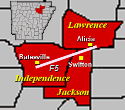
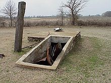
On the late afternoon of April 10, 1929, a violent tornado touched down in Independence County, then crossed into Jackson County in the Black River bottoms north of Centerville. The tornado reached its maximum intensity in Jackson County around Pleasant Valley, known locally as Possum Trot, and then on through the community of Sneed. Both communities were virtually destroyed. Historical accounts indicated the tornado was 1/2 mile wide at this point. 23 people were killed and 59 others were injured. The storm made a clean sweep of the area – homes were left in splinters with very little left. Huge trees were torn apart. At the home of one family, the mother, father and seven children were at home. The family members were scattered for 200 yards. The father and three of the children died, and the survivors all had injuries. The Pleasant Valley School was destroyed. The tornado then weakened and lifted in Lawrence County. Several other tornadoes touched down on this day. The towns of Sneed and Pleasant Valley have since become abandoned ghost towns, though an old storm shelter used on that day can still be found.
*** Sources include Tornado History Project, Wikipedia, the Storm Prediction Center, W. Irving Skipper’s images, argenweb.net, TalkWeather.com, NWS Little Rock, TheCabin.net and YouTube.
There should be other factors used besides well-built homes. The Vilonia tornado should have received an EF5 rating. There was over a foot of topsoil scoured over an underground storm shelter which was near a slabbed home. The people that were in that storm shelter said the tornado was so intense they thought they were going to be sucked out. The ground scouring from the Vilonia tornado was actually more impressive than the ground scouring in the Joplin tornado.
Agree 100%. Based on the damage photos on various sites afterwards I was all but sure it would be rated EF5 – was very surprised when they had a press event to announce it was not rated as such. There are elements of the new EF scale that I like, but the lack of continuity between it and the older F scale skews data – some old F5 tornadoes would now be EF4 and some EF4s would be F5 on the old scale. Some still point to the six or seven F5s on 4/3/74 as a benchmark when at least six, maybe seven or eight of the tornadoes on 4/27/11 would have been F5 if still using that older scale. Thanks for visiting my site!
The other two tornadoes on May 24, 2011 should have received EF5 ratings. They were both possibly of similar intensity to the El Reno tornado. The Tuscaloosa tornado I think could have went EF5, although I don’t entirely disagree with the high-end EF4 rating. El Reno 2013 tornado is too hard to say based on lack of damage indicators.
Hi Mick,
Thanks for your work in putting this article together.
I live in the mountains of western Arkansas, and I am glad that
the state does not have any EF5 tornadoes. One of the reasons that we may
not get them is that there will always be more mice than elephants. We get
some good blows that knock trees down, but tornadoes are vortexes,
and mountains seem to disrupt their flow.
When the 2009 tornado hit Mena, it cleared a wide path, but was
only rated an EF3, more than anybody wanted. When the cell
moved on to the east, our area, we did not notice even heavy winds.
Later I visited the DeQueen area where the same storm had knocked
down big trees in the flats and destroyed trailer houses in town.
I believe that places like swamps, lakes and very wet fields act like
throwing gasoline on a fire for some of these tornadoes. They really
gain power near those areas.
Good hunting,
Jim
In my opinion Arkansas is one of the most violent states for severe weather due to the amount of humidity that it has and the cold air up in the ozarks and in the air which can cause a MASSIVE AMOUNT OF INSTABILITY! But key factor is that the jet stream goes Arkansas which cause massive amounts of thunderstorms every year and over half of them are severe. Most storms fire up in Oklahoma and continue to run into Arkansas but get this, Oklahoma’s geography is very similar to Arkansas due to that both states are exxcevilly humid and are prone to Tornadoes. THe storms act like a car they move east but run out of fuel somewhere near the boarder of Oklahoma and Arkansas, thats when the storms always have more energy inside and can rotate stronger due to the amount of instabiity that the storms are getting from Arkansas Geography. And global warming is starting to pose a huge problem for tornadoes, Tornadoes now are even stronger than before and are getting stronger in the southeast and still great plains. Also Arkansas upper wind a nd lower wind patterns are pretty strong which can make those storms roate and lower down funnel clouds which will be bad for the communities that may get a direct hit by them. So all of this adding up, I think its very likely of seeing a EF5 Tornado because of the growth population and more buildings and structures in the prone parts of Arkansas.
I do agree. Although Oklahoma being a plains state is significantly flatter than arkansas with the absence of ozark like mountains.
I’m a 20 year resident of Independence County, AR, and found your article interesting concerning the 1929 tornado that swept through this county. Meteorologist Ryan Vaughn from KAIT8 Jonesboro news team mentioned this tornado while covering the weather segment sometime in 2018 or 2019, answering the question if Arkansas has ever had an F5 tornado. He shared an image of eastern Independence County, Hwy. 25, beginning just a mile or two east of Batesville, a red line indicating the path of the tornado just along and south of this highway moving in a west to east direction towards Cord. You can see at least two old homemade storm shelters built as you drive along this highway and had often wondered why they were built.
You can now add another tornado to your Arkansas list after yesterday’s tornado that swept through Jonesboro. It was harrowing to watch as I had just turned on the television to watch the local news two minutes before 5 PM. There on live-cam was the formation of a tornado from a wall cloud. Just thankful to the Lord that so far there were very few injuries.